Street Guides · Point Lookout, NY
40°35′N · 73°35′WPoint Lookout, New York
Living on…
8 guides993 parcels on the tax map
A quarter square mile, eight ways to live on it.
One Hamlet, Eight Guides
A quarter square mile, eight ways to live on it.
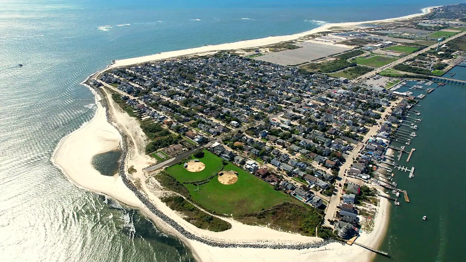
Point Lookout sits at the east end of the barrier island with water on three sides: Reynolds Channel to the north, Jones Inlet to the east, the Atlantic to the south. It runs to 0.27 square miles of land and 993 parcels on the county tax map, 823 of them carrying a house. Lido Boulevard is the only road in, and it ends inside the hamlet.
The eight guides below divide it the way people here divide it — by the bay, by the park, the ocean block, the last row before the beach, the inlet, the middle of town, and the boulevard. Each one is drawn on the county tax map and counted from the county record, so the figures are the same ones a surveyor and an assessor work from.
The zones overlap on purpose, because the ground does. The last house on Mineola Avenue is on Mineola, on the ocean block, at the ocean end and on the inlet at once, and it is counted in all four.
The Map
Every parcel in the hamlet, coloured by zone.
North is up: the bay at the top, the ocean at the bottom, Jones Inlet at the right. Point at a zone, on the map or in the list, and every parcel it counts lights up.
993 parcels from the Nassau County tax map. Point at a zone to light every parcel it counts; the zones overlap, so some parcels light up for more than one.
- Living on the bayThe north edge of the hamlet, facing Reynolds Channel.60 parcels · 39 houses
- Living on Lido BlvdThe only road in and out, and the only street that crosses every avenue.49 parcels · 19 houses
- Living on ParksideThe west border of the grid, with the Town Park across the road.60 parcels · 51 houses
- Living in the middle of townThe original village grid, between Beech Street and Lido Boulevard.453 parcels · 400 houses
- Living on Mineola by the parkThe easternmost avenue, and the last address before open ground.80 parcels · 60 houses
- Living on the inletThe row that faces Jones Inlet.66 parcels · 46 houses
- Living on the ocean blockEverything south of Beech Street, where the avenues run down to the dune.339 parcels · 289 houses
- Living on the ocean endThe last row of parcels before the beach.26 parcels · 22 houses
The Eight Guides
Pick the ground you are asking about.
Living on the bay
The north edge of the hamlet, facing Reynolds Channel.
- Houses
- 39
- Median lot
- 4,500 sq ft
- Median living area
- 2,344 sq ft
- Before 1960
- 38%
Living on Lido Blvd
The only road in and out, and the only street that crosses every avenue.
- Houses
- 19
- Median lot
- 4,000 sq ft
- Median living area
- 2,216 sq ft
- Before 1960
- 53%
Living on Parkside
The west border of the grid, with the Town Park across the road.
- Houses
- 51
- Median lot
- 4,000 sq ft
- Median living area
- 1,632 sq ft
- Before 1960
- 78%
Living in the middle of town
The original village grid, between Beech Street and Lido Boulevard.
- Houses
- 400
- Median lot
- 3,180 sq ft
- Median living area
- 1,605 sq ft
- Before 1960
- 78%
Living on Mineola by the park
The easternmost avenue, and the last address before open ground.
- Houses
- 60
- Median lot
- 4,500 sq ft
- Median living area
- 2,396 sq ft
- Before 1960
- 70%
Living on the inlet
The row that faces Jones Inlet.
- Houses
- 46
- Median lot
- 3,000 sq ft
- Median living area
- 2,292 sq ft
- Before 1960
- 76%
Living on the ocean block
Everything south of Beech Street, where the avenues run down to the dune.
- Houses
- 289
- Median lot
- 3,840 sq ft
- Median living area
- 1,794 sq ft
- Before 1960
- 84%
Living on the ocean end
The last row of parcels before the beach.
- Houses
- 22
- Median lot
- 4,475 sq ft
- Median living area
- 2,292 sq ft
- Before 1960
- 86%
Ask the office
Which side of the street, which houses see water, and what a lot can carry are the conversation, not the page.
These pages carry what the county record can prove. For the rest of it, the office is at 24A Lido Blvd, in the hamlet.
Sources
- Nassau County property cards, tax roll and GIS parcel geometry, read from the Point Realty property database
- Point Lookout, New York — Wikipedia
- Point Lookout Civic Association