Point Lookout · Lido Beach · Long Beach24A Lido Blvd · Point Lookout, NY 11569

Point Lookout · Nassau County, New York

40°35′N · 73°35′WPoint Lookout, New York

A chronology of
Point Lookout

55 entries6 eras · every one sourced

A sourced timeline of the east end of the barrier island, from the whalers' lookout to today.

The record

Fifty-five entries, from the barrier beach the glaciers left to the village on its concrete streets, each one with its sources attached.

Most of what follows comes from the Point Lookout Historical Society — its Milestones, its name history, and The Lookout, its annual journal. Photographs are used courtesy of the Point Lookout Historical Society.

Point Lookout has been settled three times. A resort hotel at the end of a marine railroad in 1881, a leased-lot bungalow colony called Nassau-by-the-Sea that burned in 1918, and the village laid out on concrete streets in 1928 that is still here. Most of the rest of the story is the shoreline: the wall, the clam shells, the jetty, and the storms that tested all three.

Five federal survey sheets

The inlet, mapped

The U.S. Geological Survey resurveyed this end of the island five times between 1897 and 1967. Read left to right, the sheets show the inlet before there was a village, the bungalow colony, the village on its concrete streets, the jetty going in, and the shoreline after it held.

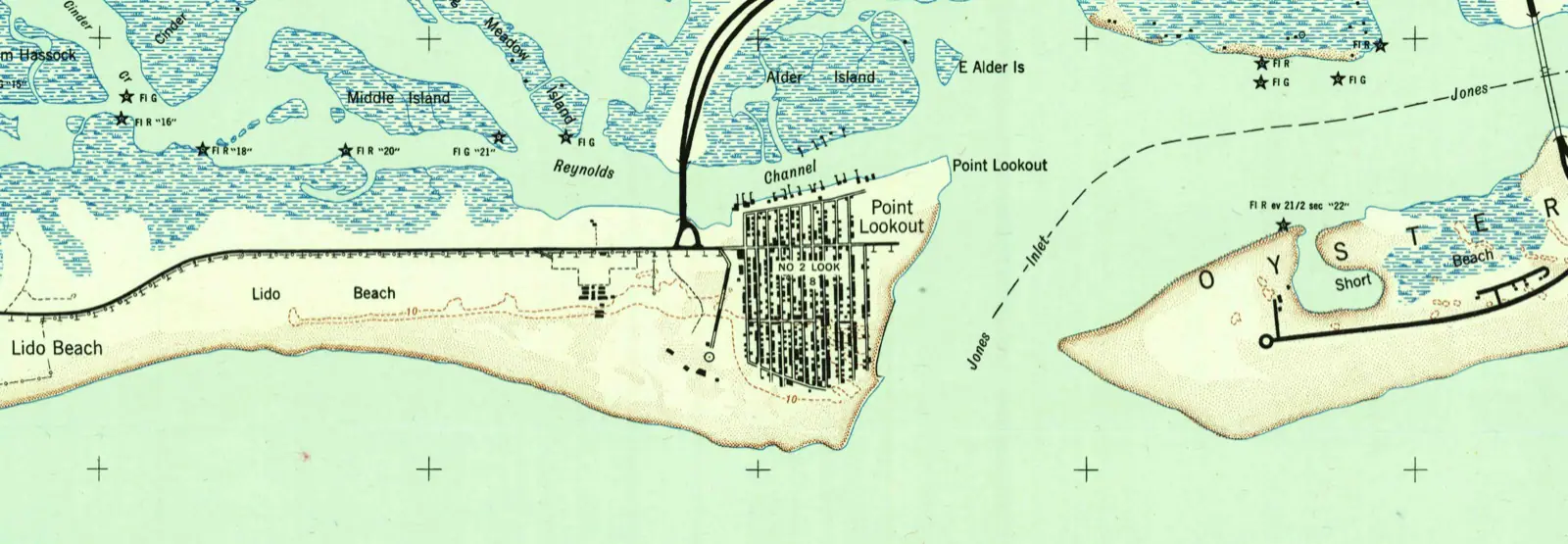
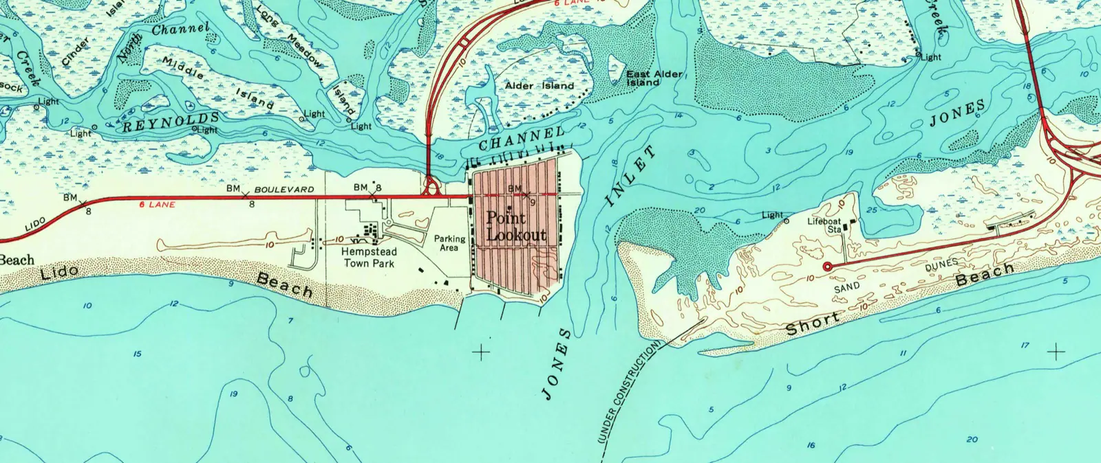
The 1947 sheet and the 1954 sheet are the pair worth stopping on: in 1947 there is no structure at the inlet, and in 1954 the sheet carries one annotated "(UNDER CONSTRUCTION)".

1947No structure at the inlet
USGS Jones Inlet quadrangle, 1947 — the village built, the Loop Parkway in, no jetty at the inlet
USGS Jones Inlet quadrangle, 1947 — the village built, the Loop Parkway in, no jetty at the inletU.S. Geological Survey, Historical Topographic Map Collection
1954Jetty under construction
USGS Jones Inlet quadrangle, 1954 — the inlet jetty marked "(UNDER CONSTRUCTION)"
USGS Jones Inlet quadrangle, 1954 — the inlet jetty marked "(UNDER CONSTRUCTION)"U.S. Geological Survey, Historical Topographic Map Collection

Every sheet, 1897 to 1967

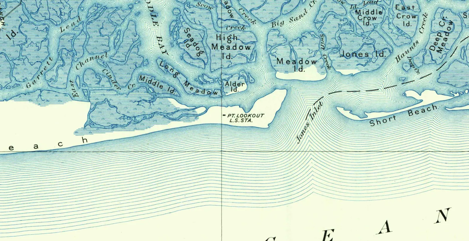
  • USGS Hempstead quadrangle, 1897 — Point Lookout and Jones Inlet detail ("PT. LOOKOUT L.S. STA.")
    1897USGS Hempstead quadrangle, 1897 — Point Lookout and Jones Inlet detail ("PT. LOOKOUT L.S. STA.")
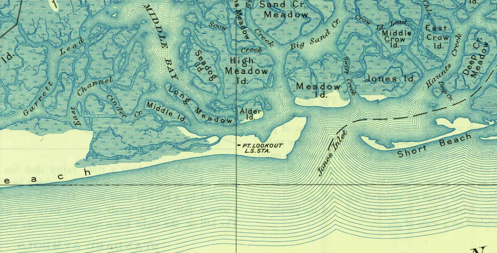
  • USGS Hempstead quadrangle, 1903 — Point Lookout and Jones Inlet detail
    1903USGS Hempstead quadrangle, 1903 — Point Lookout and Jones Inlet detail
  • USGS Jones Inlet quadrangle, 1947 — the village built, the Loop Parkway in, no jetty at the inlet
    1947USGS Jones Inlet quadrangle, 1947 — the village built, the Loop Parkway in, no jetty at the inlet
  • USGS Jones Inlet quadrangle, 1954 — the inlet jetty marked "(UNDER CONSTRUCTION)"
    1954USGS Jones Inlet quadrangle, 1954 — the inlet jetty marked "(UNDER CONSTRUCTION)"
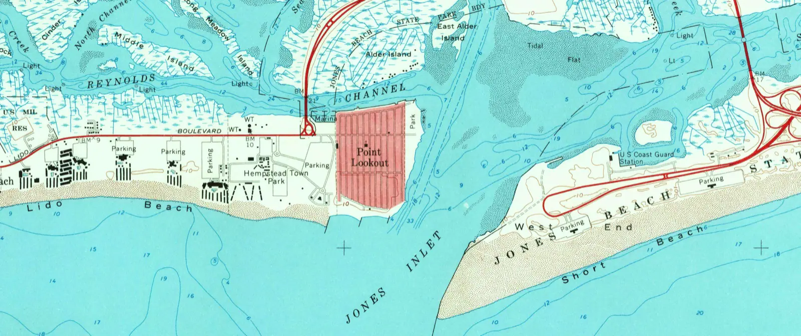
  • USGS Jones Inlet quadrangle, 1967 — the stabilised shoreline, Town Park and marina in place
    1967USGS Jones Inlet quadrangle, 1967 — the stabilised shoreline, Town Park and marina in place

U.S. Geological Survey, Historical Topographic Map Collection. Public domain.

The timeline

to 18726 entries

Before the village

c. 7000 BC

The sand arrives, and so do the Merrick

A barrier beach of glacial sand, and Algonquian people working the shore for shellfish and whales.

1643

Hempstead's settlers take up the beach

Negotiations between the Hempstead settlers and the Merrick over Long Beach Island.

1721

A whalers' lookout gives the place its name

By 1721 a lookout and station for whalemen stood on Long Beach opposite the Hummocks, near the inlet. The name is simply what it was.

1797

Long Beach Island on Stewart's mapUnconfirmed

The barrier island appears on Stewart's map of 1797. Early cartography shows a sand spit that changes shape between surveys, because it did.

USGS Hempstead quadrangle, 1897 — Point Lookout and Jones Inlet detail ("PT. LOOKOUT L.S. STA.")
USGS Hempstead quadrangle, 1897 — Point Lookout and Jones Inlet detail ("PT. LOOKOUT L.S. STA.")U.S. Geological Survey, Historical Topographic Map Collection
January
1837

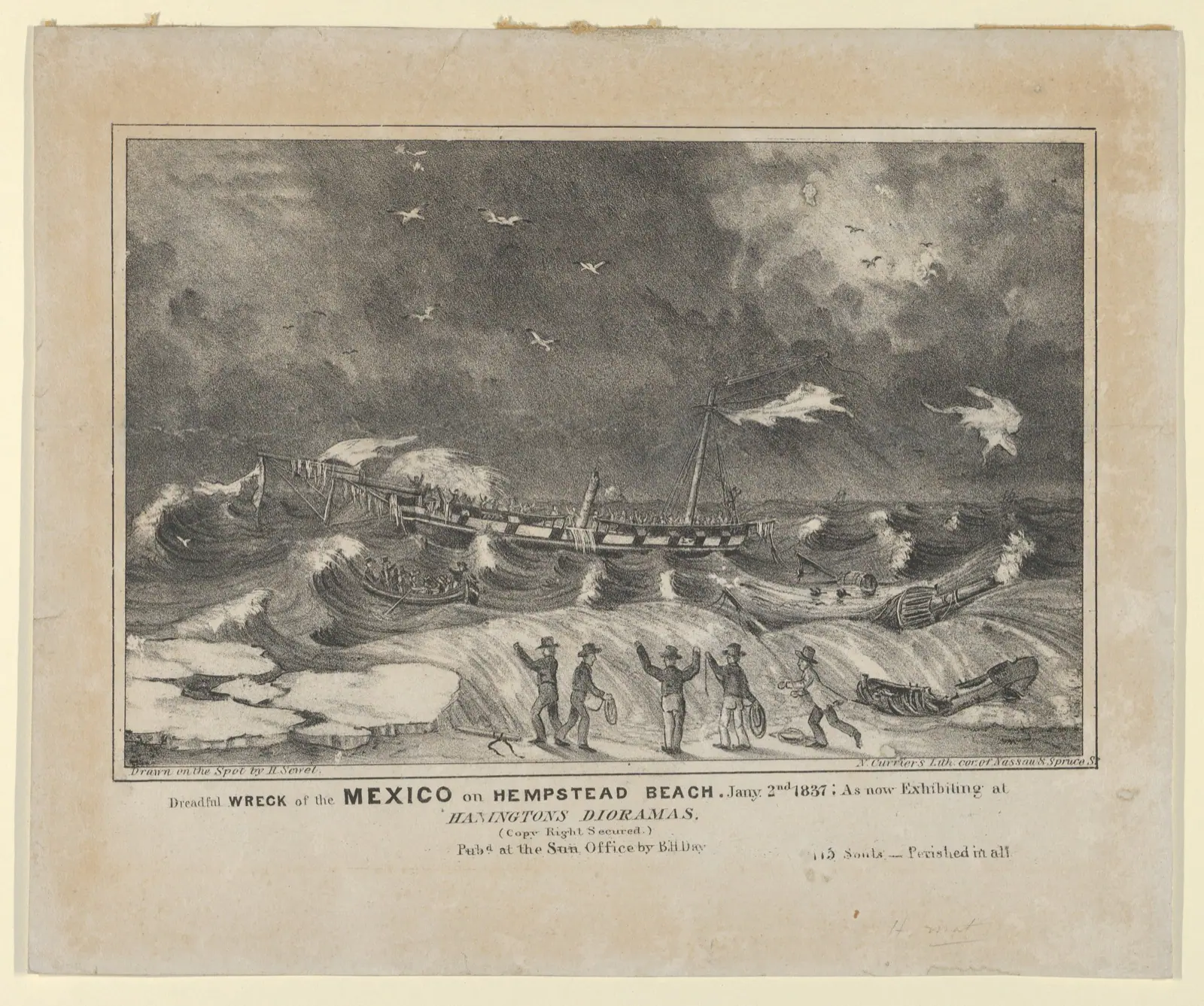
The wreck of the Mexico

The barque Mexico froze onto a bar off Hempstead Beach in sight of shore. One hundred and fifteen people died, and lifesaving stations followed on this beach.

Dreadful Wreck of the Mexico on Hempstead Beach, January 2nd, 1837, after H. Sewell
Dreadful Wreck of the Mexico on Hempstead Beach, January 2nd, 1837, after H. SewellThe Metropolitan Museum of Art
1872

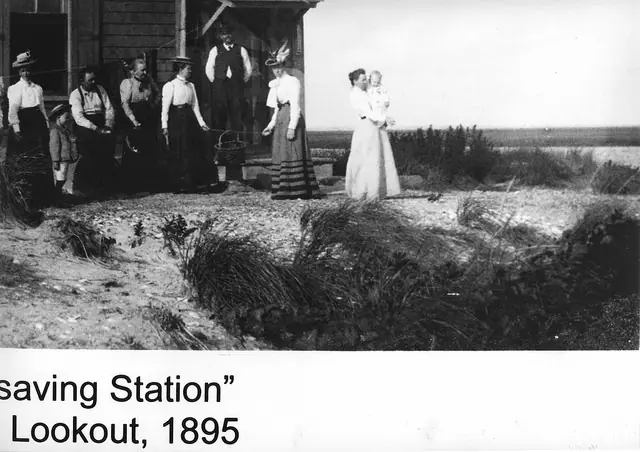
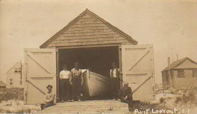
A lifesaving station on the point

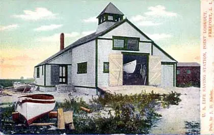
A United States Life-Saving Service station was established at Point Lookout, and took its name from the whalers' term.

Point Lookout Life Saving Station, before 1908
Point Lookout Life Saving Station, before 1908Courtesy of the Point Lookout Historical Society

1881 – 192512 entries

The resort era

May
1881

The marine railroad reaches the Point

A railroad running east along the beach from the Long Beach Hotel, built in about two months and carrying guests by May 1881.

August
1881

The Point Lookout Hotel and cottages open

A hotel set back on higher ground, a row of cottages beside it, a landing dock and sand.

1882

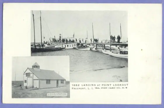
Oscar Wilde, a landing dock, and eighteen thousand visitors

The Historical Society counts Oscar Wilde among some 18,000 people who came to Point Lookout in 1882, the year a landing dock was established.

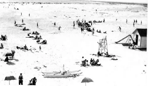
Point Lookout, 1882 — the resort era
Point Lookout, 1882 — the resort eraCourtesy of the Point Lookout Historical Society
1886

Austin Corbin buys the venture out of trouble

The resort failed, and the Long Island Rail Road's president bought the hotel and its properties. Rail service resumed in 1887.

September
1889

A hurricane takes the railroad

Cottagers abandoned their houses for the hotel as seas ran eighteen to twenty feet. The railroad was destroyed.

August
1904

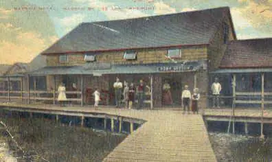
Nassau-by-the-Sea

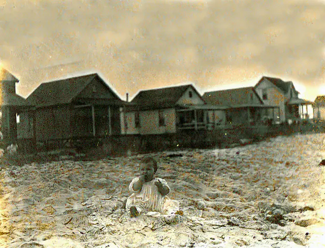
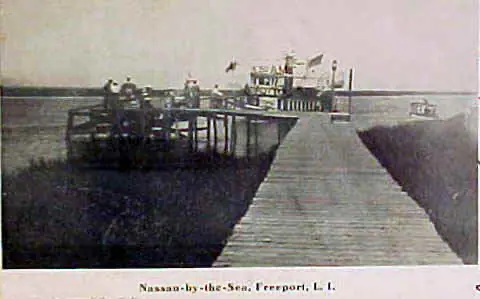
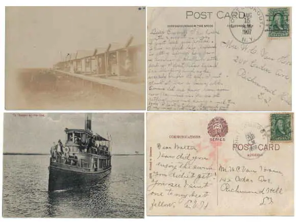
A leased-lot summer colony of bungalows on the ocean side: twenty-seven cottages in 1904, about two hundred by 1907, with board paths to the ocean.

Nassau-by-the-Sea
Nassau-by-the-SeaCourtesy of the Point Lookout Historical Society
May
1906

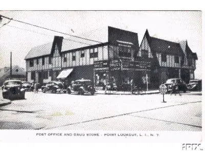
The post office makes the name official

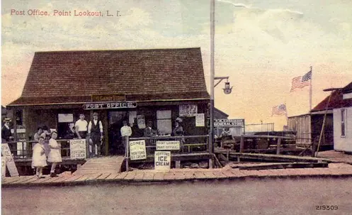
A post office established in May 1906 made Point Lookout the official name. There is still no mail delivery here.

The old post office
The old post officeCourtesy of the Point Lookout Historical Society
1906

Reynolds buys the barrier island

A Brooklyn developer bought the island, dredged the channel behind it, and set in motion the fill that Point Lookout is built on.

1911

The little church on the bayside boardwalk

A church seating fifty, built on the old boardwalk on the bay side, and a pump organ carried to it on a delivery wagon.

1915

The Lido golf course

Reynolds's Lido links opened on filled land west of Point Lookout. That stretch has been a buffer of one kind or another ever since.

May
1918

The fire that ended Nassau-by-the-Sea

A fire took the hotel, forty bungalows, the post office and the boardwalk. What survived was buried under dredged sand by 1928.

The Nassau hotel, 1921
The Nassau hotel, 1921Courtesy of the Point Lookout Historical Society
1925

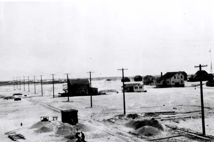
Filling the marsh to make a road

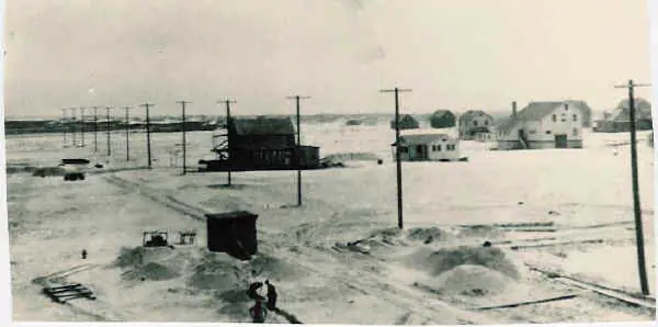
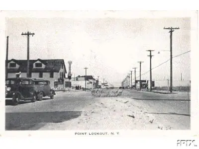
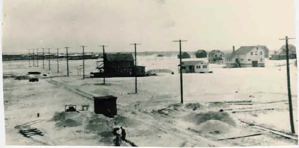
Sand dredged from Reynolds Channel became the base for a road. Lido Boulevard began as two concrete tracks with sand down the middle.

Lido Boulevard beside the power poles
Lido Boulevard beside the power polesCourtesy of the Point Lookout Historical Society

1928 – 193710 entries

Jones Beach, Moses and the parkway

1928

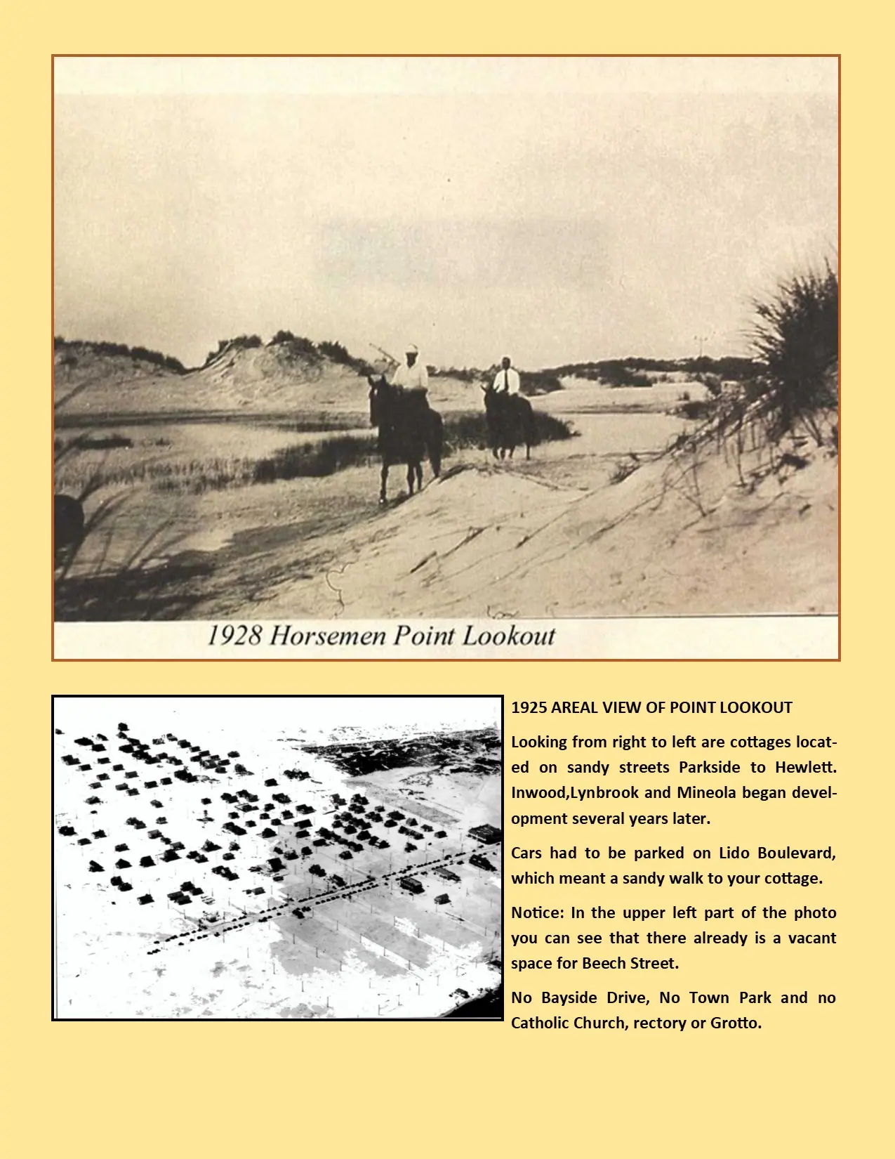
The streets, the lots, and the village that is still here

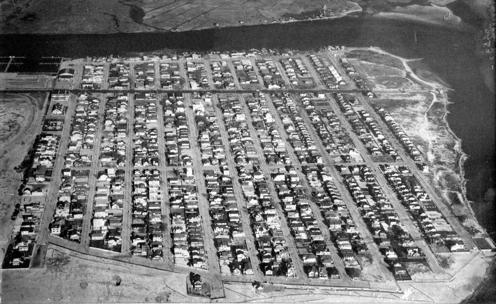
Concrete streets, small plots at about $2,500, electricity and water, and roughly a hundred houses by the end of the year.

Society exhibit panel: "1928 Horsemen Point Lookout" and "1925 Areal View of Point Lookout"
Society exhibit panel: "1928 Horsemen Point Lookout" and "1925 Areal View of Point Lookout"Courtesy of the Point Lookout Historical Society
August
1929

Jones Beach opens across the inlet

Robert Moses's first great park opened on August 4, 1929, directly across Jones Inlet from the east end of the village.

May
1930

The Point Lookout Market, and the first newspaper

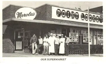
The Merola family opened the market on May 30, 1930. The Lookout, the village's first paper, began the same year at three cents a copy.

Merola's store, Lido Boulevard
Merola's store, Lido BoulevardCourtesy of the Point Lookout Historical Society
1931

The fire company

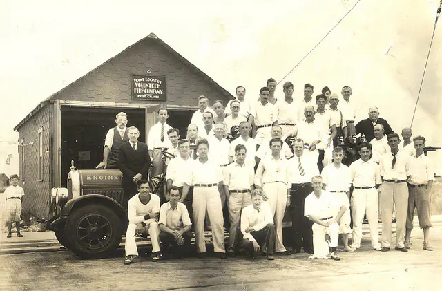
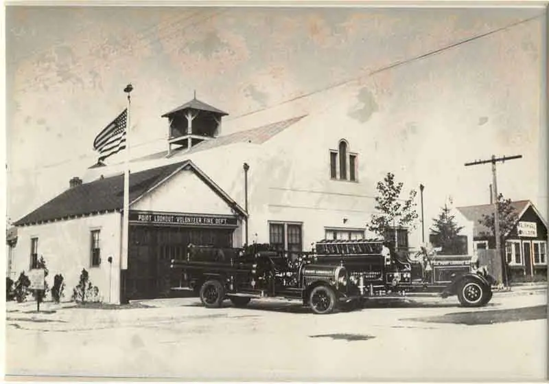
Residents organised a fire company, bought a pumper from North Bellmore for $400, and built the first firehouse themselves.

The early Point Lookout Fire Company
The early Point Lookout Fire CompanyCourtesy of the Point Lookout Historical Society
May
1931

The Civic Association

Ten citizens founded the Civic Association in May 1931. Its early fights were garbage, unpaved streets, fire protection and day-trippers' cars.

1932

The Community Church, and no parking on the streets

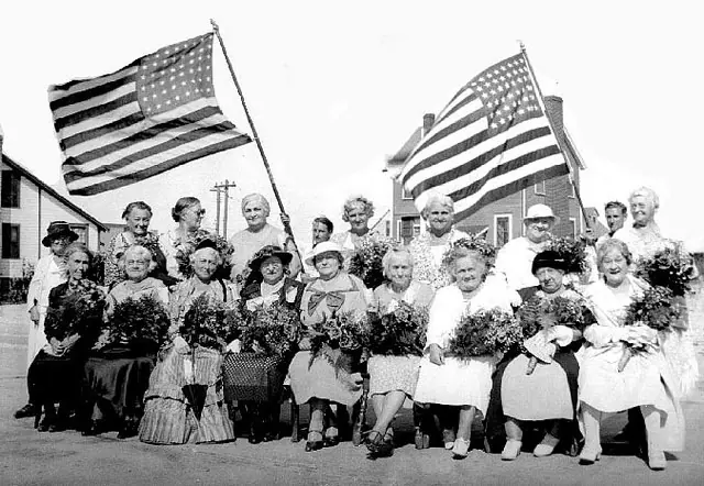
Both congregations met in the fire hall until they had buildings. The no-parking ordinance was adopted the same year and has never been repealed.

Early celebrations
Early celebrationsCourtesy of the Point Lookout Historical Society
July
1934

Ye Olde Firehouse and the community hall

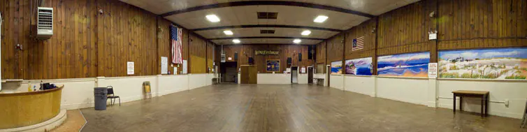
A hall built by residents, engineered by a man who had worked on the Empire State Building, and paid off with barn dances.

Ye Olde Firehouse, moved to Hewlett Avenue and Lido Boulevard in 1932
Ye Olde Firehouse, moved to Hewlett Avenue and Lido Boulevard in 1932Courtesy of the Point Lookout Historical Society
October
1934

The Loop Parkway opens

The Loop landed at Lido Boulevard in October 1934, and Point Lookout became the end of a state road rather than the end of a railroad.

1936

Zoned for single-family houses

The 1936 zoning amendment establishing single-family residences is the reason the village never became Long Beach.

Point Lookout, 1936
Point Lookout, 1936Courtesy of the Point Lookout Historical Society
1937

Our Lady of the Miraculous Medal

The Catholic parish began in 1937 and the first Mass in the new church was said in July 1938.

1938 – 19518 entries

Storms and the shoreline

September
1938

The hurricane the Point mostly survived

The Long Island Express took nearly nine thousand buildings across the region. Point Lookout came through it lightly — a chimney, a lost beach, two inches of water across the boulevard.

1940

The beach becomes the community's, and the rock wall goes up

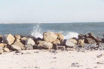
The community acquired rights to the beach and formed a park district — and in the same year the beach began to vanish.

Rock placed against the eroding inlet shore
Rock placed against the eroding inlet shoreCourtesy of the Point Lookout Historical Society
1940

Houses moved, and houses lost

One house was trucked across town ahead of the erosion. A row of beach shacks on the ocean side was not so lucky.

1944

Clam shells hold the wall

Shucked-clam shells nobody wanted were dumped seaward of the sea wall, where they overlapped into a reef that absorbed wave shock.

August
1946

One hundred and sixty-seven lots, sold on the premises

A post-war auction of 167 ocean-and-channel lots, held at the corner of Lido Boulevard and Lynbrook Avenue.

1947

Rec hall, Coast Guard station, and a newspaper that lasted

The recreation hall was dedicated, the lifesaving post closed, and the Community Outlook began publication.

The Coast Guard station, 1931
The Coast Guard station, 1931Courtesy of the Point Lookout Historical Society
November
1950

The Thanksgiving-week storm

The Great Appalachian Storm drove a peak surge of eight to nine feet along the southern Nassau shore through four successive tides.

1951

The jetty at Jones Inlet

The structure that stopped the inlet walking west through the village. The Army Corps dates the east jetty to 1951; the Historical Society records completion in 1953.

USGS Jones Inlet quadrangle, 1947 — the village built, the Loop Parkway in, no jetty at the inlet
USGS Jones Inlet quadrangle, 1947 — the village built, the Loop Parkway in, no jetty at the inletU.S. Geological Survey, Historical Topographic Map Collection

1957 – 199313 entries

The village grows

September
1957

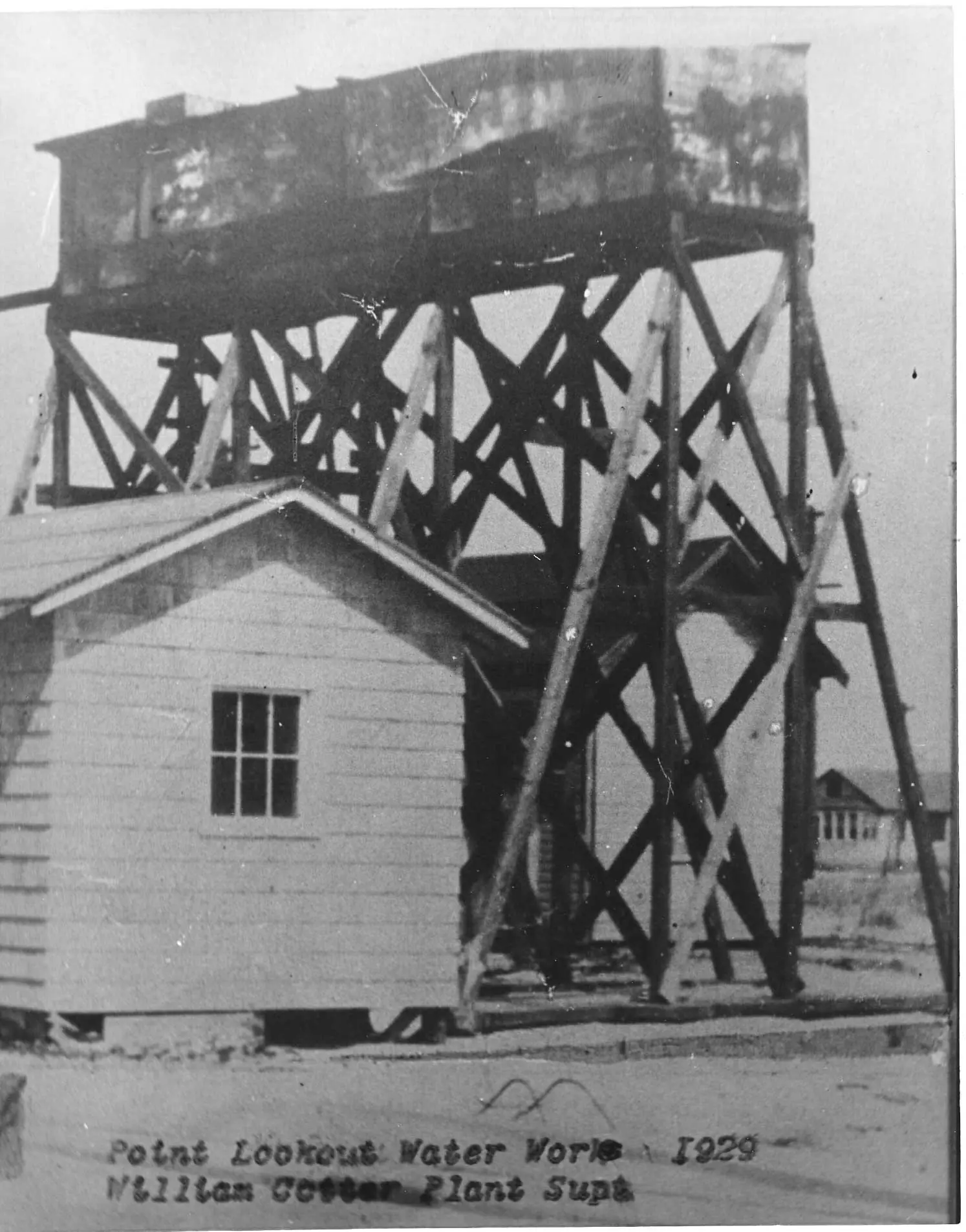
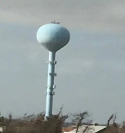
Water district, ball field, Lido firehouse

Piped water, a new ball field to replace the one the sea took, and the Lido firehouse dedicated on September 27.

The water tower
The water towerCourtesy of the Point Lookout Historical Society
1958

Rosemary Gomez opens Point Realty

A Brooklyn College professor and mother of seven started a brokerage on Lido Boulevard as a service to her neighbours. It is still in the family.

September
1960

Donna

A category two hurricane crossed Long Island on September 12, 1960, with a five-to-ten-foot surge along the south shore.

March
1962

The Ash Wednesday nor'easter

Five high tides on a spring tide, rated among the ten worst storms in the United States in the twentieth century.

1965

Parkland, trees, and a village that stayed small

The Town and the County bought oceanfront land for public parks, and a tree-planting programme began on a sand spit that had had no trees at all.

USGS Jones Inlet quadrangle, 1967 — the stabilised shoreline, Town Park and marina in place
USGS Jones Inlet quadrangle, 1967 — the stabilised shoreline, Town Park and marina in placeU.S. Geological Survey, Historical Topographic Map Collection
1967

The library residents built

Built and stocked by residents in April 1967, and still open. The art show and the Spectagala date from the following year.

1974

What Made America Famous?

Harry Chapin lived in Point Lookout, and a fire in the village became the most widely heard thing anyone has made about it.

1976

The BicentennialUnconfirmed

The village marked the national Bicentennial with its own committee and a printed insert, both of which survive in the Society's collection.

1982

Fifteen miles an hour

The 15 mph limit was legislated after two children were killed by speeding cars on village streets.

September
1985

Gloria

The last hurricane to make landfall on Long Island came ashore on September 27, 1985 and took power from two-thirds of the island.

1992

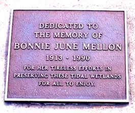
Bonnie June Mellon's marsh

Twenty-three acres of marshland dedicated to the memory of a Point Lookout environmentalist.

Bonnie June Mellon
Bonnie June MellonCourtesy of the Point Lookout Historical Society
December
1992

The December nor'easter

The storm of December 11, 1992 destroyed more than 130 houses on Long Island and set the high-water mark that stood until Sandy.

1993

The Historical Society

Founded in 1993, chartered by the State in 2013, and the reason most of this timeline can be sourced at all.

2006 – today6 entries

The present

July
2006

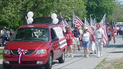
Seventy-five years, and a village that still throws a party

The Civic Association marked the village's seventy-fifth birthday at the ball fields, with booths run by the businesses on the boulevard.

A parade on Lido Boulevard
A parade on Lido BoulevardCourtesy of the Point Lookout Historical Society
March
2010

The March nor'easter

One to two feet of water from Reynolds Channel over the streets of Long Beach on the evening of March 13, 2010.

August
2011

Irene

On the morning of August 28, 2011 the ocean flooded to Park Avenue in places and the bay came up one to two blocks.

October
2012

Sandy

The water came from the bay. The dunes on the ocean side were destroyed, and the village behind them was not.

2019

The beach rebuilt, and the groins

A $130 million Army Corps project: 3.2 million cubic yards of sand, twenty-two groins, and a beach about 150 feet wider.

The rebuilt dune
The rebuilt duneCourtesy of the Point Lookout Historical Society
2026

Point Lookout now

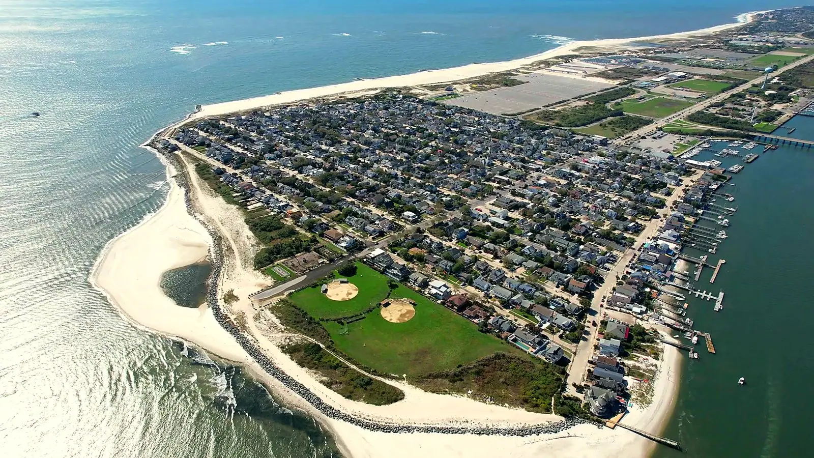
A quarter square mile, 1,527 people, 823 houses, one road in, and the same institutions the 1930s built.

Point Lookout from the air: the village, the Town Park and Jones Inlet
Point Lookout from the air: the village, the Town Park and Jones InletPoint Realty drone photograph

Point Lookout, then and now

Lido Boulevard and Bayside Drive, past and present

Point Lookout has never had more than a short row of businesses, and most of them have been more than one thing. The buildings outlast the names on them.

Open, under the same name

United States Post Office

110 Lido Blvd

Established in May 1906, which is how the village's name became official. The post office building was among what a fire destroyed in May 1918. There is still no mail delivery in Point Lookout: everybody collects.

SourcesPoint Lookout Historical Society — Origin of the Name Point Lookout (Winsche, p. 83) · Point Lookout Historical Society — Milestones
The names on the building

  1. Point Lookout post office1906Established May 1906; the name of the village became official with it. Burned with the rest of the colony in 1918 and rebuilt with the new village.
The old post office
The old post officeCourtesy of the Point Lookout Historical Society

Open, under a different name

Southdown Coffee, Pilates by the Sea, and a beach shop

40 Lido Blvd (Southdown Coffee); 40C Lido Blvd (Pilates by the Sea)

The oldest business address in the village. The Merola family opened the Point Lookout Market here on May 30, 1930 and the name stayed on the building for generations; it became Merola's IGA and was still trading, as one of the seven booths at the village's seventy-fifth birthday party, in 2006. It closed within the last fifteen years, was Aggie's and then the Food Mill, and the building has since been subdivided. Southdown Coffee, a pilates studio and a beach shop occupy it now.

SourcesPoint Lookout Historical Society — Milestones (Point Lookout Market, May 30, 1930) · The Lookout, Vol. 1 No. 1 (Merola's IGA at the 2006 party) · Yelp — Southdown Coffee, 40 Lido Blvd, Point Lookout · Yelp — Pilates by the Sea, 40C Lido Blvd, Point Lookout · the BEACH shop, 40 Lido Blvd, Point Lookout (Instagram)
The names on the building

  1. Point Lookout Market (Merola's)1930Opened by the Merola family on May 30, 1930; later Merola's IGA. Closed within the last fifteen years.
  2. Aggie'sFollowed Merola's in the same building.
  3. The Food MillFollowed Aggie's.
  4. Southdown Coffee, a pilates studio and a beach shopThe building was subdivided; three tenants today.
Merola's store, Lido Boulevard
Merola's store, Lido BoulevardCourtesy of the Point Lookout Historical Society

JoJo's Beachside Cafe

85 Lido Blvd

JoJo Apples ran for about thirty years and was one of the seven businesses that took a booth at the village's seventy-fifth birthday party in 2006. It reopened in 2026 as JoJo's Beachside Cafe after a winter renovation, under a new operator who has lived in Point Lookout twenty years.

SourcesGreater Long Island — JoJo Apples unveils new name, identity after renovations in Point Lookout (July 18, 2026) · JoJo's Beachside Cafe · The Lookout, Vol. 1 No. 1 (JoJo Apples at the 2006 party)

The names on the building

  1. JoJo Applesto 2026About thirty years under that name.
  2. JoJo's Beachside Cafe2026Renamed in 2026 after a four-month winter renovation, under a new operator.

MO'NELISA Italian Restaurant & Pizzeria

28 Lido Blvd

Olive Oil's was one of the businesses running a booth at the 2006 birthday party. MO'NELISA — the spelling is MO'NELISA, a play on Mona Lisa built from the owners' names — opened at 28 Lido Blvd in 2016 and serves pizza in the pizzeria and Italian food in the dining room and on the patio.

SourcesMO'NELISA — official site · Yelp — MO'NELISA, 28A Lido Blvd, Point Lookout · The Lookout, Vol. 1 No. 1 (Olive Oil's at the 2006 party)

The names on the building

  1. Olive Oil'sTrading in 2006.
  2. MO'NELISA2016Established 2016.

The Buoy Bar and Scotty's on the Bay

72 Bayside Dr

Established in 1929 as a fishing station — a marina, a bait-and-tackle stop and a place to stand around — and open ever since on Reynolds Channel. Today it is two operations on one waterfront property: The Buoy Bar for sit-down dining and Scotty's on the Bay, counter service beside the children's beach. The old engine room is part of the restaurant kitchen.

SourcesScotty's on the Bay (Buoy Bar site) — established 1929 · Yelp — The Buoy Bar, 72 Bayside Dr, Point Lookout · The Lookout, Vol. 1 No. 1 (Scotty's Buoy Bar at the 2006 party)

The names on the building

  1. Scotty's Fishing Station1929A marina, bait-and-tackle stop and gathering place.
  2. Scotty's Buoy Bar / The Buoy BarOpen. Scotty's on the Bay is the counter-service side, beside the children's beach; the former engine room is now part of the restaurant kitchen.

Ted's Fishing Station

143 Bayside Dr

A working fishing station on Bayside Drive for at least ninety years. A 1930s recollection in The Lookout has Lou Pearsall owning the station that is now Ted's, with the street-cleaning contract and his horses stabled out in the dunes. It was Ed's before it was Ted's. Today it rents boats and rods, sells bait, and runs a clam shack and a small bar.

SourcesTed's Fishing Station · Yelp — Ted's Fishing Station, 143 Bayside Dr, Point Lookout · The Lookout, Vol. 1 No. 1 (Lou Pearsall's fishing station)

The names on the building

  1. Pearsall's fishing stationPer a 1930s recollection: Lou Pearsall owned the fishing station that is now Ted's, and had the contract to clean the streets, keeping his horses in stables out in the dunes.
  2. Ed'sPaul's account: it was Ed's before it was Ted's.
  3. Ted's Fishing StationOpen. Boat and rod rentals, bait, and a clam shack.

The Fisherman's Catch — now entirely a clam bar

111 Bayside Dr

In August 1933 a group calling itself Ye Ladies of Point Lookout staged a play with a cast of thirty-six here, in what was then Gus Gebert's Tavern, to raise money for the fire department building fund. The Lookout's 2006 editors identified the building as the Fisherman's Catch. It operates entirely as a clam bar now.

SourcesThe Lookout, Vol. 1 No. 1 (Gus Gebert's Tavern, editors' note: 'now The Fisherman's Catch')

The names on the building

  1. Gus Gebert's TavernPer the 2006 account: in August 1933 a group calling itself Ye Ladies of Point Lookout put on a play here, with a cast of thirty-six, for the fire department building fund. The 2006 editors note the building as then being The Fisherman's Catch.
  2. The Fisherman's CatchNow operating entirely as a clam bar.
The Fisherman's Catch
The Fisherman's CatchCourtesy of the Point Lookout Historical Society

Point Realty

24A Lido Blvd

Founded in 1958 by Rosemary Gomez, a Brooklyn College professor and mother of seven, as a service to friends and neighbours who needed help buying and selling houses. Three generations of licensed brokers since — Rosemary Gomez, Paul A. Gomez, Paul J. Gomez. The first office was next to the firehouse on Lido Boulevard; the firm later moved to 24A Lido Blvd, which had been the Point Gardening Center.

SourcesPoint Realty — Frequently Asked Questions · Paul J. Gomez, Licensed Broker — family account, September 2026

The names on the building

  1. Point Realty, first office1958Next to the firehouse on Lido Blvd, in the storefront now occupied by a tax business.
  2. Point Realty, 24A Lido BlvdThe building had been the Point Gardening Center. No date known for the move.

Closed

Lauder's restaurantUnconfirmed

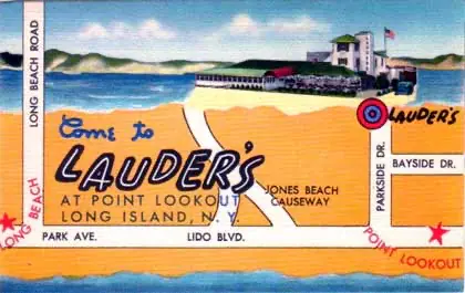
The Historical Society holds a photograph captioned as Lauder's restaurant. Nothing else about it turned up in the sources searched.

SourcesPoint Lookout Historical Society — gallery

The names on the building

  1. Lauder's restaurantIn the Historical Society's picture collection; no dates found.
Lauder's restaurant
Lauder's restaurantCourtesy of the Point Lookout Historical Society

Add to the record

Share your family's photographs

Much of what is on this page came out of the Point Lookout Historical Society’s collection. Plenty more is still in albums and shoeboxes in the village — the old storefronts, the houses before they were raised, the streets before the trees.

If you have something, send it to the office and we will credit it to you.

By sending a photo you confirm you may share it and allow Point Realty and the Historical Society to display it with credit.

Historical photographs courtesy of the Point Lookout Historical Society. Maps from the U.S. Geological Survey’s Historical Topographic Map Collection. Point Realty, 24A Lido Blvd, Point Lookout, NY 11569.