Street Guides · Point Lookout, NY
40°35′N · 73°35′WPoint Lookout, New York
Living on Lido Blvd
49 parcels · 19 housesCounted from the county tax map
The only road in and out, and the only street that crosses every avenue.
The Zone
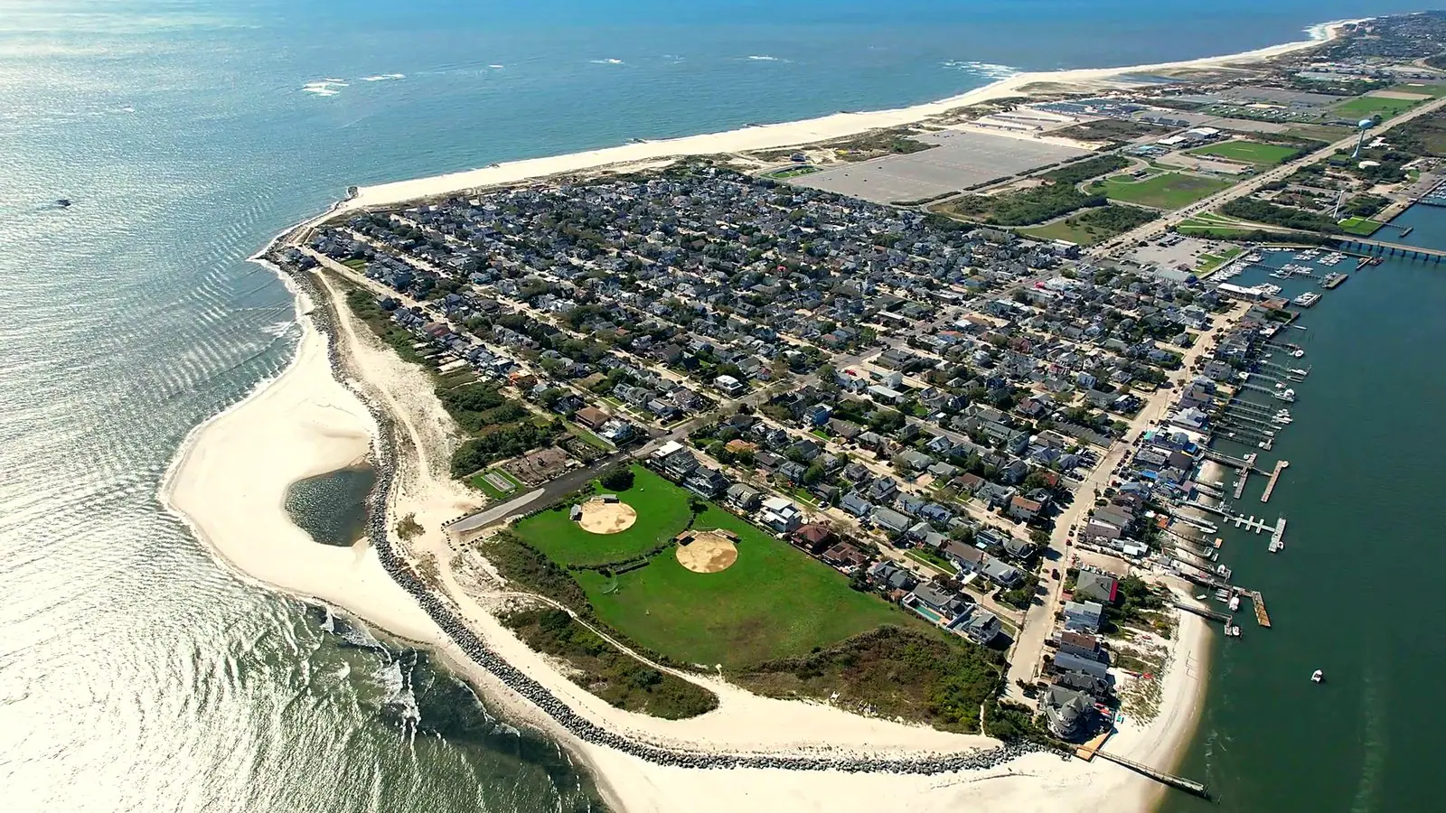
Lido Boulevard is the only road into Point Lookout and the only road out. It ends inside the hamlet, so nothing passes through. It carries what the hamlet needs — the post office at 110 Lido Boulevard, where every household collects its mail because there is no home delivery here, and a short row of businesses — and then, east of the shops, a residential stretch. Of 49 parcels on the boulevard, 19 hold houses; the rest are business parcels, accessory lots and the public tracts at either end, the Town Park at 1300 Lido Boulevard among them. Thirty-seven of the 49 are corner parcels, which is what a street that crosses every avenue produces. The houses are the most rebuilt in town by share: 42 percent of them post-date 2000, against 9 to 26 percent in every other zone, on a median 4,000 sq ft lot with a median 2,216 sq ft of living area. The bay is three minutes on foot, the ocean seven.
- Parcels
- 49
- Houses
- 19
- Median lot
- 4,000 sq ft
- Median living area
- 2,216 sq ft
How the zone is drawn
Every parcel addressed on Lido Boulevard within Point Lookout, from the Town Park at the west end to the residential stretch east of the shops. Lido Boulevard is the only road in and out of the hamlet and the only street that crosses every avenue.
StreetsLido Boulevard
The Record
What the county card says.
Every figure here is counted from Nassau County property cards, the tax roll and the county parcel map, measured on this zone's own boundary and set beside the hamlet as a whole.
Prices and taxes are not on this page. Those depend on the house, and we would rather talk them through than publish an average that fits none of them.
What is in the zone
- Parcels on the tax map
- 49
- Houses
- 19
- Share of the hamlet's housesPoint Lookout has 823 in all
- 2%
- Accessory or vacant tax-map lots
- 27
- Public or institutional tracts
- 3
- Corner parcels
- 37
The lots and the houses
- Typical lotMost fall between 4,000 and 6,200 sq ft · hamlet median 4,000
- 4,000 sq ft
- Typical living areaMost fall between 1,240 and 3,555 sq ft · hamlet median 1,733
- 2,216 sq ft
- Median year builtOldest county card 1920, newest 2020
- 1950
- Houses with an open edgeA median 60 ft of it. An open edge is a lot boundary facing water, park or open ground rather than a neighbouring lot. It is not a measure of water frontage or of a view.
- 1
- Most common county styles
- Colonial · 10
- Old Style · 3
- Bungalow / Cottage · 2
- Contemporary · 2
Original and rebuilt
- Built before 196010 houses · hamlet 77%
- 53%
- Built 1960 or later9 houses · hamlet 23%
- 47%
- Built 2000 or later8 houses · hamlet 12%
- 42%
On foot, from the middle of the zone
- To the duneRange 7–8 min
- 7 min
- To the bay at Bayside DriveRange 2–3 min
- 3 min
- To Lido BoulevardRange 0–1 min
- 0 min
- To the Town Park entranceRange 2–8 min
- 4 min
Walking times are estimated from parcel locations at an easy walking pace. No route was walked.
Original means a county year built before 1960, rebuilt means 1960 or later. A gut rebuild sometimes keeps its original year on the county card, so the original share is an upper bound.
The zones overlap on purpose, because the ground does. Every figure is counted on the zone's own full definition, so the counts add up to more than the hamlet total.
What a page cannot hold
Which side of the street, which houses see water, and what a lot can carry are the conversation, not the page.
Every figure above comes from the county record, and the county record stops well short of what you actually want to know about a block. Call the office and ask. We are at 24A Lido Blvd, inside the hamlet, and we have been selling these streets since 1958.
Next Door
The ground either side of this one.
Living on the ocean block
Everything south of Beech Street, where the avenues run down to the dune.
1 parcel sits in both
Living in the middle of town
The original village grid, between Beech Street and Lido Boulevard.
Living on the bay
The north edge of the hamlet, facing Reynolds Channel.
Living on Mineola by the park
The easternmost avenue, and the last address before open ground.
Sources
- Nassau County property cards, tax roll and GIS parcel geometry, read from the Point Realty property database
- Point Lookout, New York — Wikipedia
- Town Park at Point Lookout — Town of Hempstead